Читайте также:
|
In May 1921 Riza Nur, a member of the Turkish Assembly, wrote to general Kazim Karabekir, commander of the Eastern Front, ordering that "the relics and the traces of the monuments of Ani be wiped off the face of the earth". He added "You will be rendering a great service to Turkey when you accomplish this goal" І. Karabekir recorded in his memoirs that he replied dismissively to Nur, saying that the Ani ruins were vast, like the walls of Istanbul, and that even if they were destroyed - which in itself would be a very difficult task - they would still remain as ruins on the same spot. He also warned that the destruction of Ani would be likely to stir up sentiment amongst the Armenian religious community.
Some destruction did take place. Most of what seems to have been destroyed were the visible results of Nikolai Marr's excavations, including most of his repairs and restorations. Certain structures that would have been seen as having symbolic importance to Armenians may also have been destroyed at this time (such as the tomb of King Ashot at Horomos, and the khatchkar monument of Catholicos Barsegh).
Many Armenian monuments in the vicinity of Ani have been destroyed since 1920. The dates of their destruction are not exactly known. See the pages on the Khtzkonk and Bagnayr monasteries, the Tekor basilica, and Magazberd for examples.
Even though the 1921 order for the total demolition of Ani was not carried out, the history of Ani since the 1920s has been one of continuous and increasing destruction. The reasons for this can be placed into several categories:
THE MONASTERY OF KHTZKONK
History
"...the ongoing and relentless efforts of republican Turkey to destroy any remaining Armenian historical monuments and to eliminate any evidence of historic Armenia. The markers and monuments testifying to the existence of the Armenian people in their homeland have thus become the final victims of the genocide begun in 1915."
- Robert Jebejian
This beautiful monastery, also known as "Beshkilise" (Turkish for "Five Churches"), was spread out over three spurs of rock within a gorge near the village of Digor (formerly called Tekor), about 25km south-west of Ani.
The monastery had a total of five churches, all of them domed and carefully built out of finely cut stone. The churches were called: Saint Karapet, Saint Astucacin, Saint Stephanos, Saint Gregory, and Saint Sargis. Only the church of Saint Sargis is standing today.
THE MONASTERY OF BAGNAYR
History
The remains of the Armenian monastery of Bagnayr now lie within the Kurdish village of Kozluca, on the lower flanks of the Ala Dag hill, several miles to the west of Ani.
The name "Bagnayr" means "cave of the fire altars", suggesting the much earlier presence of a Zoroastrian sanctuary on the site.
Dates for the monastery's history can be found in several medieval Armenian literary sources - the 11th century historian Stephanos Asoghik says that Vahram Pahlavuni founded the monastery in the year 989.
By the 1040s it had become a major religious centre, and the Pahlavuni and their vassals continued their patronage into the 13th century. Building inscriptions record the founding of a chapel in 1145, another around the year 1200, and a third chapel in 1223 or 1229.
The most recent inscriptions were from the second half of the 13th century, and the monastery was probably abandoned at the end of the 13th century when control of the region was lost to nomadic Turkish tribes.
During the 19th century the abandoned monastery served as a summer residence for nomads. At the end of that century most of the monastery was still in a fairly good state of preservation. The extensive destruction since then is unfortunately typical of what has happened to most Armenian monuments in Turkey.
The Hexagonal Chapel
To the north of the main complex is a small hexagonal chapel that has escaped the destruction inflicted on the rest of the monastery.
The interior has six arms with the entrance in the westerly one, and is preceded by a rectangular outer enclosure built of crude masonry.
There is a damaged inscription dated 1223 on its walls, but the church is probably much earlier - from the ninth or (more likely) the tenth century. The interior is similar to the late tenth century church of St. Gregory of the Abughamrents in Ani, which was also founded by the Pahlavuni family. Today, the chapel and its enclosure are used as a cattle pen.
A fragmentary masonry structure near the hexagonal chapel is probably the remains of what in the 1870s was described as a domed church whose facing stone had been removed - it may have been of one of the 13th century chapels mentioned in the history
section at the top of this page.
THE TEKOR BASILICA / THE CHURCH OF SAINT SARGIS
History
The now scant remains of this important fifth century church stand on a slope overlooking the village of Digor, formerly called Tekor, located 22km southwest of Ani.
The building stood intact until the year 1912, when an earthquake caused the collapse of the dome, most of the roof, and much of the southern facade. In some books this 1912 date varies. Another earthquake in 1936 caused an unknown amount of additional damage. The present condition of the remains - with only fragments of the concrete core remaining, entirely stripped of facing stone - is mostly the work of man rather than earthquakes.
An inscription on the lintel over the western entrance described the structure as "this Saint Sargis' martyrion" and said that it was built by Prince Sahak Kamsarakan and consecrated by the Patriarch Yohan Mandakuni. The mentioning of these individuals dates the church to the 480s. This inscription was the oldest known example of Armenian lettering and ran, unusually, from bottom to top.
The building was restored during the time of the Bagratids, at which time it was known as the Holy Trinity church.
Description
This church is now generally held to be the earliest known domed Armenian church.
Formerly it was believed that the church was built as a basilica without a dome (possibly of pre-Christian origin and converted to a church by adding an apse) and that the dome was added later; as late as the seventh century according to some.
According to current opinion, the church was build from the outset as a domed building with a "cross within a rectangular perimeter" plan.
The earlier theory was derived mainly from observations of the pillars, now impossible to verify (although it is possible that something may remain below today's ground level). The change in hue between the lower and upper courses of stone, clearly visible on old photographs, was also said to indicate an alteration of the original design. However, there is not an obvious break in construction visible within the surviving fragments of the concrete core - perhaps this change of hue was decorative.
MAGAZBERD FORTRESS
(And Some Nearby Sites)
History
The fortress of Magazberd is situated on a rocky outcrop above a bend in the Akhurian river, about four kilometres to the south-west of Ani.
There may have been a castle here as far back as the 6th century - or earlier - but the bulk of the present structure probably dates from the time of the kingdom of Ani. At the end of the 12th century, after the Georgians had expelled the Muslim rulers of Ani, Magazberd and other fortresses formed a protective ring around Ani. To the north of Ani another castle, called Tiknis, survived until recently - and near Tiknis the ninth century church of Shirakawan, later converted to a fortified tower, survived until the 1950s.
Magazberd was captured by the Ottoman Turks in 1579. It was garrisoned by them at least until the mid 17th century, since a Persian-Ottoman treaty of 1637 stipulated that it (and other border defences) should be dismantled. Some sort of civilian settlement probably continued at Magazberd until the mid 19th century.
Description
The site is protected on three sides by vertical cliffs, and the main fortification is a short double wall defending the vulnerable northern side. The inner wall resembles the walls of Ani. It has three tall, and very closely set, semicircular towers. It may date from the early 11th century, or from a rebuilding in the early 13th century. The outer wall is much lower and is probably a construction from Ottoman period: it resembles the Ottoman walls of Kars and Ardahan.
Magazberd was actually a small town - inside the walls were the ruins of houses, several chapels, a palace, a cistern, and other structures. An underground passage linked the castle to an entrance beside the river. The exact current condition of Magazberd is unknown - although external views suggest that it is little changed, except that the outer entrance shown on old photographs has been destroyed.
Nearby Sites
To the south of Magazberd there were formerly a number of important buildings dating from the time of the Kamsarakans - the predecessors of the Bagratid rulers of Ani. Unfortunately little has survived the last 80 years of Turkish rule.
The Church in Alaman (Alem)
Alem (formerly called Alaman) is a village about ten kilometres to the south of Magazberd. It once had an Armenian church dedicated to Saint Anania. Nothing now remains of it - presumably it became another victim of Turkey’s policy of cultural genocide against Armenian monuments.
The church was a small, domed building with a triconch plan and a rectangular entrance arm to the west. An inscription recorded its founding by Prince Grigor Eghustr and his wife Mariam in the year 637, and also named Nerseh Kamsarakan, the local ruler at that time.
The Churches in Agarak (Ekrek)
Ekrek (formerly called Agarak) is a village further to the south of Alem and a little to the south of Digor. At least until the 1920s it had a domed Armenian church of an early date - today it is totally destroyed (all that is left is a few fragments of concrete). Next to it was the ruins of a single naved church - also now demolished.
The Church in Zipni (Varlэ)
In the village of Varlэ (formerly called Zipni), about eight kilometers south of Digor, there is a church that is now converted to a mosque. It was originally a domed building with a cruciform plan. By the start of the 20th century the dome has been completely destroyed - probably after an earthquake - but the structure still served as a church and had a wooden roof to replace the missing dome. Zipni at that time had 300 households, all of them Armenian.
Nakhijevan (Kocakцy)
In the village of Kocakцy (formerly called Nakhijevan) there was a church, probably a basilica, that was in ruins by the start of the 20th century. Nothing now remains except bits of the concrete core of its walls.
Today Kocakцy is just a small village, but it was once a small town and an important place. Close to the church was (perhaps still is) an underground structure built around the year 360 as a mausoleum for the Kamsarakan dynasty. This comprised a pair of rectangular tomb chambers built of rough stone, each about 4 metres long and oriented east-west. A short passage built of cut stone linked the chambers to the outside. The roofs of these chambers were slightly above ground level, but hidden under a low mound. In 1920 Kalantar noticed that in one chamber was a tombstone for a Prince Artavazd (this stone survived until sometime after 1964) and that there were traces of two other underground mausoleums in the village.
Damage Due To Natural Events
An earthquake in 1935 is said to have destroyed most of the Oрuzlu church. Half of the church of the Redeemer collapsed during a storm in 1957. The Russian excavators had repaired this building. The Georgian church had collapsed by the 1960s, this building had also been repaired by the Russians. The church of the Shepherd and the citadel church known as the "mausoleum of the child princes" were destroyed in another earthquake in 1966. The southern half of the "palace church" probably collapsed during the same earthquake. The earthquake that devastated northern Armenia on the 7th December 1988 was also felt at Ani. There was damage to the city walls, to the narthex of the Tigran Honents church, and, in particular, to the north-west corner of the cathedral, which collapsed.
MONUMENTS LOCATED TO THE NORTH OF ANI
The Church in Oрuzlu Village
A grey hulk of masonry - the remains of a large Armenian church - dominates the village of Oрuzlu, 16km north of Ani.
The original Armenian name of this church is not known, but an undated inscription on its wall states that it was built by a certain Hassan Gnt'uni. He has been identified as the military governor of Kars during the reign of King Smbat (890-914), and since Smbat is not mentioned in the inscription it is also suggested that it may have been built after Kars rebelled against and temporarily broke away from Smbat's rule in the first decade of the 10th century. Another inscription, now destroyed, recorded that the church was renovated by "prince of princes" Ashot Pahlavid in the year 1001.
At a later date the south-western corner of the church must have collapsed - it is constructed from smaller blocks of stone than the rest of the building. Perhaps at the same time (the masonry looks similar) the external walls were heightened and the entrances either walled up or reduced in size. This probably indicates the conversion of the church into a fortified place of refuge - a similar conversion happened to the nearby church of Shirakawan.
The church was still intact during first quarter of the 20th century. The dome and the south-west corner are said to have collapsed during an earthquake in 1936. The fallen masonry was probably plundered for building materials.
The Church Called Kizil Kilise
In the tiny village of Yaрэkesen, 6km east of Oguzlu and 15km north of Ani, is an old church that is known as "Kizil Kilise" in Turkish, "Karmir Vank" in Armenian. Both names mean the same: the "Red Church". Since there is a similar church in Armenia also called Karmir Vank, the name Kizil Kilise will be used here.
The church stands on a low rise of land beside a small river, in the midst of a treeless and gently rolling grassland. The silhouette of its conical roof, visible for many miles away, seems in sympathy with the distant mountain peaks on the horizon.
Little is known about its history, and its original medieval name is unknown. During the 19th century it was used as the village's church and was officially called Surp Astuacacin (the Church of the Holy Mother of God).
The building apparently suffered damage during the 1877 Russo-Turkish War, but was later repaired. This repair is recorded in a long inscription on the tympanum over the doorway that tells of the restoration of the church by the priest Salatiel Ter Davit'eanc "by his own hands". Despite the prominence and size of the inscription, this restoration (which took place during the 1880s) probably consisted only of re-facing the saddle roof, and possibly rebuilding of the conical roof over the dome.
The settlement remained an Armenian village until 1920 when its inhabitants were forced to evacuate their homes and migrate to Soviet Armenia. The church is still in fairly good condition and is currently used as a barn.
The general design of Kizil Kilise could point to a tenth century date, but decorative features on its walls suggest a rather later period than this - perhaps the early 11th century, but more likely the late 12th / early 13th century. The 13th century date is backed by an inscription inside the church dated the year 1218, recording a donation made by a woman named Talit'a.
THE GEORGIAN CHURCH
Description
This church was a large, rectangular structure with a double-pitched roof and no dome. Internally, it had a single nave ending in a semicircular apse. The entrance appears to have been on the west elevation. Along the internal north and south walls was an arcade of three bays separated by engaged columns. Arches rising from these columns crossed the width of the nave and supported a barrel vaulted roof. There was a window in the apse, and in at least one bay of the south wall (not shown on the plan below).
The Georgian Inscriptions
On part of the south wall was an inscription in Georgian, dated 1288. When the fallen remains of the rest of the south wall were excavated in 1910, another inscription in Georgian was recovered. This inscription was discovered on 44 facing blocks of stone, out of a probable original 50, and was 20 lines long. The fragments were removed, re-assembled, and displayed outside the Ani museum (the Minuchihr mosque). After the First World War the inscription vanished. In 1998 five of the missing blocks were discovered built into the walls of houses in Ani (Ocakli) village.
THE CHURCH OF THE SHEPHERD
History
This unique building was located outside Ani's city walls, several hundred metres to the north-west and on the route to Horomos monastery. Already badly ruined by the start of the 20th century, it was almost entirely destroyed by an earthquake in 1966. Some remains survive of it - they are visible from the road approaching Ani but are within an inaccessible military zone.
The church bore no inscriptions, and nothing is known about its history. Its name, the "Church of the Shepherd", came from a traditional story that a shepherd had it built after his wife had complained that all the churches within Ani were too noisy and crowded for quiet prayer.
THE CITADEL OF ANI
History
At the southern end of Ani the ground rises up to form a flat-topped hill. This part of Ani is known as the "Inner Fortress" (Midjnaberd in Armenian), or simply as the "citadel". As well as having natural defences of steep cliffs on three sides, the citadel was encircled by a single line of ramparts. This wall had towers on its north facing section, and an entrance gateway at its north-western corner.
The citadel ramparts are presumed to date, in part, from the time that the Kamsarakan dynasty ruled Ani (the seventh century AD), but additional work was done on them until the thirteenth century.
The Frescoes
The interior is entirely covered with frescoes of the same date as the church. They have two main themes - the Life of Christ and the Life of Saint Gregory the Illuminator (to whom the church was dedicated).
The dome contains a damaged depiction of the Ascension in the form of a bust of Christ carried by four angels, underneath which are shown Mary and the twelve Apostles.
The eastern half of the church contains scenes from the life of Christ - including the Annunciation; the Nativity; the entrance to Jerusalem; the raising of Lazarus; etc.
In the semidome of the apse is a figure of Christ, below this is a depiction of Christ in Communion with his Apostles, below this again is a row of bishops or prophets (these have been recently destroyed by whitewash).
The western chamber of the church contains 16 scenes from the life of Saint Gregory the Illuminator - including his trial before king Trdat; the various tortures inflicted upon him (including his imprisonment in a pit); the martyrdom of St. Hripsime; the baptism of King Trdat and the kings of Georgia, Abkhazia, and Caucasian Albania; etc.
Above the door to the chapel south of the apse is an unusual panel containing motifs that evoke silk textile designs of that time. Four linked medallions each enclose a simurgh, a mythical lion-headed bird from Persian legend.
As mentioned earlier, the narthex also contained frescoes - these are mostly now destroyed or badly damaged due to weathering. They are from a slightly later period than those in the church, and are different in style, having a finer and more Byzantine character to them. On the exterior wall of the church, above and to the right of the entrance, is a depiction of the Crucifixion. The Lamentation of Mary is depicted on the other side.
On the north wall of the narthex is a now very faded image of Paradise, with Isaac, Jacob, Abraham, Mary, Adam, and a Tetramorph creature guarding the Gate of Heaven. There are also figures of saints or prophets on the underside of the arches.
Recent Damage to the Frescoes
The defacing of faces in the frescoes by Muslims objecting to the depiction of images is predictable. The more accessible paintings have also been heavily damaged in recent years by tourist graffiti (both Turkish and foreign).
However the most serious damage is of a bizarre sort. In an effort to hide the graffiti damage, large areas of the frescoes have been covered in whitewash! The frescoes on the northern wall of the church were particularly badly damaged by graffiti (including a large CND symbol hacked into the plaster). To "tidy" this section up the entire lower registry of paintings has simply been chipped off.
This damage occurred in the early 1990s - during the period of professor Beyhan Karamaрaralэ's excavations (see Ani - recent history) - and must have taken a considerable amount of time and effort to accomplish. It could not have been done without the use of scaffolding or ladders, and must have been officially sanctioned.
THE CATHEDRAL OF ANI
History
Near the southern edge of the city stands the imposing Cathedral. This is the largest and most important building in Ani, and a structure of world architectural importance.
According to various historical sources and inscriptions, it is known that building work started in the year 989 under King Smbat II (977-89) and was completed, after a halt in construction, by the year 1001 (or 1010 depending on the reading of the inscription) by order of Queen Katranideh (Catherine), the wife of King Gagik Bagratuni, Smbat's successor. The cathedral was the work of Trdat, one of the most celebrated architects of medieval Armenia.

THE CHURCH OF THE REDEEMER
(SURP AMENAP'RKITCH)
History
This large church was completed around the year 1035, and the walls are covered with long and elegantly carved inscriptions that reveal much of its history.
The inscription partially reproduced above records that the church was commissioned by prince Ablgharib Pahlavid to house a fragment of the True Cross. He had obtained this relic after a visit to Constantinople, and in the inscription he commanded that nightly services should be held within this church until the second coming of Christ.
Other inscriptions record a restoration of 1193, by a priest named Trdat, in which twin zhamatuns (outer halls) were added to house pilgrims; and another from 1291, recording that a man named Mkhitar had built a bell tower in front of the entrance. These structures have entirely vanished except for the concrete staining on parts of the facade. Another inscription tells that in 1342, prince Vahram Zakarid ordered a restoration of the cupola that was undertaken by the architect Vasil. There is also an inscription on the upper part of the south facade bearing the name "Trdat". Some have identified this Trdat as the famous architect Trdat, designer of the Ani cathedral and King Gagik's circular church. This is unlikely: the earliest known works by Trdat are from the 970s, so he was probably dead by the time this church was being constructed. The name may actually refer to the same Trdat who is mentioned in the 1193 restoration inscription.
The Frescoes
There are faint frescoes in the walls and semi-domes of each surviving apse, and on the pendentives. They are of high quality and are rather Byzantine in style, but the painter was an Armenian - Sargis P'artchkans. They probably date from the end of the 13th century (perhaps from the 1291 restoration). At a later date they seem to have been covered in whitewash (was the church once used a mosque?) and are now in a very damaged condition. The destroyed altar apse had a painting of Christ enthroned, the other apses contained scenes related to the life of Christ and the four Evangelists.
APHRODISIAS
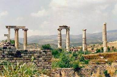
The ancient city of Aphrodisias, once the capital of the province of Lydia, is located near the village of Geyre in the district of Karacasu 38 km south of Nazilli.In ancient times, the attractive marble buildings of Aphrodisias no doubt shone out, as they do now, from amidst the rich vegetation of the Dandalaz valley with its almond, pomegranate and poplar trees.
The wealth and cultural and political importance of the city is clearly attested by the size and magnificence of the buildings of which it is composed.The name Aphrodisias is derived from Aphrodite, the goddess of nature, beauty, love and plenty, and was one of the most famous cult centres of the goddess. But this was not the original name of the city. According to the historian Stephanus it was founded by the Lelegians and was first known as Lelegonopolis.The name of the city was later changed to Megalopolis, and later again to Ninoe after Ninos, the King of Assyria.
The history of the city can be traced back to the early bronze age and there is even clear evidence of a chalcolithic culture prior to the 3rd millennium B.C. The use of the name Aphrodisias began after the 3rd century B.C., in the Hellenistic period.The spread of Christianity under the Byzantine Empire and the gradual adoption of Christianity as the state religion resulted in a marked change in the status of the city. The cult centre of Aphrodite declined in importance, to such an extent that the names Aphrodite and Aphrodisias were finally erased from all the inscriptions. Efforts were made to change the name of the city to Stavrapolis, the City of the Cross, but the local inhabitants preferred to use Caria, the name of the province. Geyre, the name of the modern village occupying the same site, is probably a corruption of the ancient Caria, which occurred after the Turkish occupation of the area. It seems very likely that in Turkish, Caria was first pronounced Kayra, and that the "k" then changed to "g" and the "a" to "e'. Like several other Roman and Byzantine cities, Aphrodisias was very largely self sufficient.
Aphrodisias was one of the foremost cities of the age, surrounded by fertile fields producing every type of foodstuff. It also possessed a flourishing wool and cotton industry, highly developed commercial, political, religious and cultural institutions,very fine tradition of arts and crafts, world-famous schools of philosophy and sculpture and a large and energetic body of citizens.
The decline of the city was hastened by an unfortunate incident that took place in the 7th century. The reign of the Emperor Heraclius (610-641) was marked by Arab raids and incursions from the East, religious disputes, political and economic pressures and a number of epidemics causing great loss of life, but the final stroke was dealt by a devastating earthquake. The damage caused to the buildings by this earthquake is still plainly visible. Some of the most imposing buildings were destroyed and remained unrepaired.
Very little is known of the history of the city after the 7th century, sources of information being confined to a few religious documents and lists of the names of the bishops. Archaeological finds, however, would appear to point to a short lived revival in the 11th century.
The incursion of the Seljuk Turks from Anatolia between the 11 Th. and 13th century.
meant the end of the settlements that had survived the great earthquakes. After the 13th century the whole province became subject to the Aydэn and Mentese Emirates. In the 15th and 16th centuries the fertile soil of the area attracted new settlement and the site of the ancient city of Aphrodisias was occupied by the village of Geyre.
Дата добавления: 2015-10-29; просмотров: 143 | Нарушение авторских прав
| <== предыдущая страница | | | следующая страница ==> |
| Architectural Properties | | | The Ruins, the City Defense Walls and City Plan |